
 Contact
 How to shop
Delivery
Shopping guide
Mapping India
 English
 333 b
333 b
Up to 30 days for returns
Customers also purchased






 /
/
 Paperback
 12 686
Ft
12 686
Ft












 /
Paperback
4 028
Ft
/
Paperback
4 028
Ft






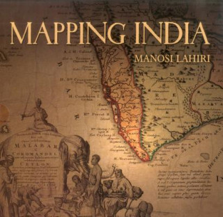
It began five hundred years ago when the very first modern maps of India were drafted. Travellers, wanderers, explorers and traders came overland from the West and carried back tales about the India of their perception. The first maps of India were drawn based on the accounts of these men. When the sea route to India opened, sailors ferried back information about the ports they touched on their way to India. Marine charts of the routes along the ocean coasts and artistic representations of port cities followed. As Europeans came in large numbers to trade and conquer, new territories further inland were mapped. The British surveyed and mapped India under their rule to settle borders, calculate tributes, assess taxes and record defence positions. At the end of the colonial period, once again maps identified the boundary between the new nations of India and Pakistan on maps of the sub-continent. "Mapping India" presents an overview of important maps that eloquently reflect the changing social and political fortunes of India. These maps speak of the commercial interests and wars that led to the colonisation of India, and show territories the size of countries that were conquered, ceded or controlled through treaties. They also record changed courses of rivers, routes taken by armies, people living in communities in new cities, places where famines occurred, how the highest peak was discovered and named, when native royalty gathered to pay respect to the British Emperor, and the destination to which Mahatma Gandhi marched with his supporters for the salt satyagraha. From the earliest chronicles of India to its post-Independence strides, "Mapping India" is the story of India recounted through its maps.


About the book
English

Give this book today
It's easy
1 Add to cart and choose Deliver as present at the checkout 2 We'll send you a voucher 3 The book will arrive at the recipient's addressYou might also be interested in







 /
Paperback
10 476
Ft
/
Paperback
10 476
Ft
 /
Paperback
15 982
Ft
/
Paperback
15 982
Ft


 /
Paperback
5 953
Ft
/
Paperback
5 953
Ft

 /
Paperback
16 760
Ft
/
Paperback
16 760
Ft



Hi! I'm Libroamiko, your book advisor.
How can I help you?